


Politicheskaya karta mira. Federativnoe ustroystvo
Political map of the world. Federal structure
Book Description
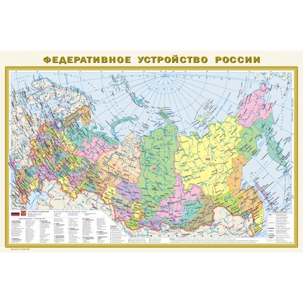
The double-sided wall map has dimensions of 870x580 mm. On one side of it is a political map of the world on a scale of 1:40,000,000 (in 1 cm 400 km), on the other is a map of the "Federal Structure of Russia" on a scale of 1:10,000,000 (in 1 cm 100 km). On the Political Map of the world, all independent states with their capitals, as well as possessions and territories with a special status are shown in color and signatures. Settlements on the map are given in three gradations of number: more than 1 million inhabitants, from 100 thousand to 1 million, less than 100 thousand inhabitants. The map of Russia shows all 85 constituent entities of the Federation, including the Republic of Crimea and Sevastopol, with their capitals and centers. The subjects of the Russian Federation are grouped into 9 federal districts. The main railway and automobile communication routes are shown. Recommended for a wide range of users. The card is packed in a transparent tube (a bag with a volumetric bottom and a europlot) made of soft plastic. Tube dimensions: length 590 mm, diameter 50 mm.
No reviews found